")
One of the most obvious uses for GNSS systems is the realization of surveys and production of maps. Although a simple standalone GNSS Receiver might not have the required precision for some survey requirements, most of these requirements can be fulfilled using high-end dual frequency multi-constellation receivers built specifically for surveying and by using GNSS Augmentation techniques.
The use of GNSS techniques in geodesy have revolutionized the way geodetic measurements are made. An increasing number of national governments and regional organizations are using GNSS measurements as the basis for their geodetic networks.
1. Land Surveying
Land Surveying is a technique and science of accurately measuring the distances and angles between different points, on the surface of Earth. GNSS has been used by land surveyors since the late 1980s, primarily for geodetic control networks and for photo control.
Nowadays, GNSS is used to determine precise locations all over the globe, in any weather conditions and at any time of the day. GNSS geodetic surveying equipment has become smaller and easier to use being faster to use than other surveying methods. GNSS is specially used for large topographic surveys where a centimeter level accuracy is enough.

Application Architecture
Land surveying usually relies on geodetic control networks that will be used as reference points and surveys are made in relation to these reference points. In detail surveys the traditional survey techniques rely on measurements from other known locations, such as the edge of properties, landmarks, or even a surveyor's stake. These land references, are subject to change over the time. With the use GNSS the coordinates can be located precisely on a worldwide reference frame and the GNSS land surveying tools produce measurements that do not rely on what happens to the surrounding land, constructions or landmarks.
Usually GNSS survey equipment use GNSS augmentation techniques to achieve the required level of accuracy. These techniques can range from the use of satellite based augmentation systems such as EGNOS or WAAS to dual frequency receivers using Real Time Kinematic (RTK). The augmentation technique is chosen depending on the required accuracy of the survey, the available equipment resources, the time required for the survey and the environmental characteristics of the surveyed site.
Typically survey grade receivers use DGNSS or Real Time Kinematic (RTK). These techniques require data from a base station with accurate and known coordinates. The base station data can be obtained from a base station network, a single public station or a own base station setup by the surveyor. Also the surveyor can chose between realtime corrections (requiring a communication link between the station and the rover) or post-processing correction.
In general terms GNSS high-end surveying equipment is more expensive than high-end traditional surveying equipment but when used for large topographic surveys where centimeter level accuracy is enough the added cost of the equipment becomes irrelevant given that it can be much faster than traditional methods. Traditional methods are still able to achieve better accuracies and are still the best option for surveys where: sub-centimeter accuracies are required, in situations where a clear view of the sky is not available or if vertical accuracy is important. In general, for detail surveying for construction, the traditional methods are still preferred.
Survey Techniques
GNSS survey techniques can be separated into the following methods:
Static Surveys - In a static GNSS survey, the receiver remain fixed during the period of observation, that is usually called occupation time. The occupation time refers to the time for how long the rover unit should be kept static to achieve the desired level of accuracy. Longer occupation times will lead to higher accuracy. Occupation times range normally from 10 minutes to 6 hours, although higher values may be used. Carrier-phase techniques are usually used in this kind of surveys.
Dynamic Surveys - In dynamic surveys, the rover unit will move around the site observing the same satellites as the base station. This type of survey provides a high rate of coordinate generation at the cost of having a lower accuracy than static methods. Kinematic methods are usually used for this kind of surveys. The algorithms used in dynamic surveys rely on the fact that while the rover can move around the site should never loose lock on the satellites signal. The techniques and algorithms used in dynamic surveys can be used in post-processing.
Real-time dynamic surveys - Real Time Dynamic Surveys use the same techniques and algorithms than dynamic surveys except that these algorithms are run on realtime on the rover units. This type of survey requires a permanent communication link between the base station and the rover.
Application Examples
Land surveying makes use of several equipments such as transits, tape, theodolites and GNSS receivers. Modern instruments rely on GNSS and lasers for measurements.
The following companies are prominent in GNSS land surveying equipments market:
Ashtech,
Hemisphere GPS,
Nikon Optical Instruments, produces Robotic and Optical instruments for land surveying.
Sokkia,
Spectra Precision,
Trimble.
2. Mapping & GIS
Mapping and GIS applications allow to capture, store, manipulate, analyze, manage, and present all types of geographically referenced data. GIS technology combines database, mapping and statistical methods to integrate georeferenced data into visual displays where the relationships, patterns and trends in the data can be more easily identified.
Although Mapping and GIS applications do not rely on GNSS as sole means for data capture, the widespread of the GNSS technologies has allowed for low-cost data acquisition processes that made GIS technologies to be more generally used.
 Application Architecture
Over the past decades GIS has became a multi-billion Euro industry. In parallel, the advent of satellite navigation provided a valuable tool for surveyors, hydrographers, geodesists, geophysicists and other environmental scientists in general. GIS systems are nowadays largely used not only in the science domain, but also in commercial and public service activities.
In Mapping and GIS, GNSS is used essentially for data capture. Traditionally data capture is one of more time consuming processes in GIS applications. GNSS has allowed low-cost automatic processes for the capture of georeferenced data.
Managers of both fixed and mobile assets and business analysts throughout the world routinely use geographical information systems (GIS). Fixed physical assets such as street furniture, power and telecom infrastructure are just some of the assets whose efficient management is facilitated by modern GIS applications. Digital map displays are routinely used in fleet management systems for vehicles of all types, relying heavily on GIS technology. Digital maps are fundamental components for in-car navigation systems.
The use of GNSS for data capture of georeferenced data is normally done using two main approaches:
Surveys - One of the main ways GNSS is used for the data capture of GIS information is through surveys. Surveys are normally done with high-accuracy receivers and are usually labor intensive activities.
Operational Georeferenced Data - The pervasive use of low-cost GNSS receivers has allowed that operational data coming from logistics systems or other business support systems is automatically georeferenced. These systems are able to generate large amounts of georeferenced data by a marginal cost. The accuracy of this data can range from meter to tens of meter level accuracies.
Application Characterization
GIS can be used in all markets across the economy. Some of the things that GIS can do are:
Map Locations - Mapping the location of things helps people to find features or patterns.
Map Quantities - Quantities can be mapped with color codes in order to understand how they vary across the territory.
Map Densities - Mapping densities is similar to mapping quantities but taking in account territory area.
Map Specific Areas - Mapping what is happening in a specific area.
Map Change - Mapping change can help to anticipate and understand future change and needs.
An example of the usefulness of mapping and GIS and how GNSS enabled the low-cost mapping of infrastructures is utility infrastructure mapping.
Utility Infrastructure Mapping
Electronic mapping systems of utility infrastructure (electrical, water, telecommunications, gas, etc) can reduce outage time by about 20% and lead to more efficient operation of the utility facilities. The precise locations of utility poles or pipes, distribution boxes and even customers can be mapped using GNSS receivers. During outages or other failures, the critical infrastructure can be identified immediately. With larger outages, maintenance crews can be dispatched to locations that will help the most customers.
Application Examples
Over the past decades the Mapping & GIS industry has witnessed continued growth. Some major players in the commercial market are :
ESRI - Considered market leader. Products include ArcView and ArcGIS.
Intergraph - Main product family is GeoMedia
GE Energy Smallworld - GE Energy sells Smallworld Geospatial Solutions with focus on the utility market.
MDA - MacDonald, Dettwiler and Associates - Mapping solutions.
Bentley Systems - Products include Bentley Map and MicroStation.
Pitney Bowes Business Insight - Products include MapInfo and MapXtreme.
Autodesk - Products include Map 3D, Topobase, MapGuide and other products that interface with AutoCAD software package.
There are several open source initiatives with a strong support base. Some of these initiatives are :
GRASS GIS – Complete GIS originally developed by the U.S. Army Corps of Engineers.
SAGA GIS – GIS used for editing spatial data and for the implementation of geoscientific methods.
Quantum GIS – Multiplatform GIS.
MapWindow GIS – Mapping application and set of programmable mapping components.
ILWIS – GIS/Remote sensing software for both vector and raster processing.
uDig - GIS software based on the Eclipse platform featuring a full layered Open Source GIS.
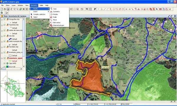
gvSIG – Open source GIS written in Java.
OpenJUMP – Java based vector GIS and programming framework.
Along with these initiatives, cloud-centric consumer products are being increasingly used for GIS. The most notable of these initiatives are:
Google Earth and Google Maps
Microsoft Bing Maps
While Google's and Microsoft's initiative are based in commercially licensed maps there are some initiatives of collaborative open source mapping. The most notable initiative in this area is OpenStreetMap.
3. Aerial Surveys
Aerial Survey is a form of collection of geographical information using airborne vehicles. The collection of information can be made using different technologies such as aerial photography, radar, laser or from remote sensing imagery using other bands of the electromagnetic spectrum, such as infrared, gamma, or ultraviolet. For the information collected to be useful this information needs to be georeferenced. The georeferencing of information is usually done using GNSS with similar techniques as the techniques used for dynamic land surveying.

Application Architecture
Aerial Surveying is normally done using manned aeroplanes where the sensors (cameras, radars, lasers, detectors, etc) and the GNSS receiver are setup and are calibrated for the adequate georeferencing of the collected data. Apart from manned aeroplanes, other aerial vehicles can be also used such as UAVs, balloons, helicopters.
Usually for this type of applications, kinematic methods are used. The algorithms used in these dynamic surveys rely on the fact that while the receiver move through the air should never loose lock on the satellites signal. The techniques and algorithms used can be used in post-processing since usually the positioning data is not required in real-time.
Multiple sensors of different or similar types can be used in order to collect different types of information or to be able to build 3D computer models of the terrain (e.g. stereoscopic cameras).
The data collected can be used for different purposes such as:
Sea surveys (sea level, temperature, undulation, etc)
Land survey (cartography, topography, feature recognition, etc)
Monitoring vegetation and ground cover
Reconnaissance
Application Characterization
The 3D visualization of the data collected by aerial surveys can be created by georeferencing the aerial photos and other sensor data (laser, radar,...) in the same reference frame, orthorectifying the aerial photos, and then draping the orthorectified images on top of the other sensors grid. It is also possible to create digital terrain models and thus 3D visualisations using multiple aerial photographs. Techniques such as adaptive least squares stereo matching are then used to produce a dense array of correspondences which are transformed through a camera model to produce a dense array of x, y, z data which can be used to produce digital terrain model and orthoimage products.
Application Examples
Two of the most used forms of Aerial Survey are:
Aerial Laser Profiling - Aerial Laser Profiling uses short duration laser pulses that are emitted towards the ground, reflected and detected by a receiver in the airborne vehicle. The time between the emission of the pulse and the reception can be used to determined the distance travelled by the pulse.
Aerial Photogrammetry - In aerial photogrammetry aerial photos are taken in order to produce 2D or 3D terrain models. Multiple cameras might need to be used to build 3D models.
Source/Reference : Navipedia.net
thnk u john
ReplyDelete