 The tremendous potential of GIS to benefit the health care industry is just now beginning to be realized. Both public and private sectors are developing innovative ways to harness the data integration and spatial visualization power of GIS. The types of companies and organizations adopting GIS span the health care spectrum--from public health departments and public health policy and research organizations to hospitals, medical centers, and health insurance organizations.
Esri has over 5,000 health care clients worldwide who are using the resource integration capabilities of GIS to create analytical and descriptive solutions. GIS plays a critical role in determining where and when to intervene, improving the quality of care, increasing accessibility of service, finding more cost-effective delivery modes, and preserving patient confidentiality while satisfying the needs of the research community for data accessibility.
Using GIS for Public Health
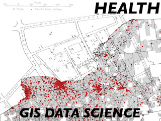
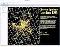
 In 1854, an English physician, John Snow, provided the classic example of how mapping can be used in epidemiological research. He identified the water source responsible for an outbreak of cholera in London by mapping the locations of those afflicted. GIS has continued to be used in public health for epidemiological studies. By tracking the sources of diseases and the movements of contagions, agencies can respond more effectively to outbreaks of disease by identifying at-risk populations and targeting intervention.
Public health uses of GIS include tracking child immunizations, conducting health policy research, and establishing service areas and districts. GIS provides a way to move data from the project level so that it can be used by the entire organization. Clinical and administrative information can be disseminated in a visual and geographic manner that is readily understood using Esri Internet Map Server (IMS) technology. This health data can be easily accessed using an Intranet or the Internet
Balancing individual privacy with data accessibility has become more challenging for public health agencies. "Spatially Enabling Vital Health Care Data" features an article that describes the South Carolina Department of Health and Environmental Control's program for managing georeferenced health records. The department aggregated health record data at the census tract level so that the privacy of individual patients was preserved while allowing easy access to data through the use of an ArcView GIS query tool.
Quick access to medical records is crucial to effective treatment. A new program that will make electronic medical records available for all armed services members, their dependents, and retirees has placed the Department of Defense at the forefront of GIS application development for health care. The department will pursue a patient-centric GIS approach that focuses on the development of information around the patient, in contrast to the approach used by the computerized medical record industry that builds information around each episode or encounter a patient has with the health care system.
The Business of Health Care Geographics
While health care professionals in the public health sector were early adopters of GIS and continue to find new and innovative uses for this technology, the use of GIS in the private health sector has grown substantially in the last decade. Private sector use now encompasses applications in marketing and business management as well as those concerned with patient care. These applications take into consideration the unique constraints under which the health care industry must operate.
Health care providers can no longer afford to indulge in the "build it and they will come" fallacy. Health care is a repeat business. Though many hospitals and medical centers have operated under Reilly's law of retail gravity--more square footage equals a larger trade area to draw from--they have begun to realize that to be competitive they need to be located conveniently to their customer base.
Site analysis operates a little differently for hospitals and medical centers. Unlike other types of businesses, hospital locations continue to be dictated by Certificate of Need (CON) programs in many states. This eliminates relocation as a method for improving the market from which hospitals draw patients and leaves health care providers with two methods of encouraging growth. Both require effective site analysis.
Providers can find new markets by increasing the range of services they offer based on an analysis of patient needs, both present and future, in their market area. This allows growth without requiring relocation. Another stationary strategy involves identifying and cultivating a hospital's most profitable services. This strategy includes studying competitors to learn about the services they offer and populations they serve and to gauge how profitable they are.
Using GIS for demographic analysis to estimate the demand for various types of services can benefit individual physicians. Physician specialties are more effectively marketed by locating offices near pools of potential patients. This type of analysis can be extended for use by managed health care providers.
How consumers access the services of managed health care providers is controlled by geographic location. Matching physician locations to where employees live or work assures that primary care physicians are available throughout the network and that the types of specialties required by specific populations are located reasonably close to these populations. Employers favor providers with networks that minimize the distance employees must travel to obtain care.
"Mapping Health Care Networks" tells how Esri business partner GeoHealth Incorporated of Redlands, California, has developed an ArcView GIS application that helps managed care providers balance the location, type, and patient workload of physicians in their network.
A Wealth of Tools
Managing patient care environments within hospitals and medical centers has become an increasingly complex task. Caregivers require critical information that is readily available in a visually streamlined format. Loma Linda University Medical Center, one of the world's premier medical research centers, uses a GIS-based system called the Patient Location and Care Environment System (PLACES) to let caregivers see the physical bed location of each patient and to retrieve demographic and clinical information.
PLACE uses an ArcView GIS application to view computer-aided design/computer-aided manufacturing (CAD/CAM) floor drawings that show room and bed locations for each floor and are tied to daily census information. When the system is complete, physicians will be able to log on to an Intranet to retrieve the location and other relevant information on their patients. Patient admission will also be improved because admitting personnel will be able to quickly identify available beds.
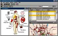
 The use of mapping to improve health care services doesn't stop at the building level. BodyViewer, an ArcView GIS extension developed by GeoHealth Incorporated, allows users in the health care industry to analyze, visualize, and map more than 14,000 of the International Classification of Diseases, Ninth Revision (ICD-9) codes that are used throughout the health care industry to index every known ailment, treatment, and procedure. BodyViewer logically aggregates these ICD-9 codes and displays them graphically as organs and organ systems. The user can build a map showing where these aggregated ICD-9 codes occur geographically.
Business management and marketing practices for private sector health care companies have been enhanced through the use of various GIS software packages from Esri. ArcView Business Analyst provides the data and ease of use that make product line planning more effective by geographically linking operational data to patient and provider location data. Areas that are underserved can be pinpointed. Marketing strategies and promotions can be more effectively targeted to the populations that would benefit from them through the use of ArcView Business Analyst.
Health care organizations can use GIS to improve management practices. Many health organizations employ sales personnel. BusinessMAP PRO provides a fast and easy way to balance sales territories, track prospects, and perform limited market analysis. Using ArcView GIS, medical supplies and equipment can be visually located and inventoried. Linking the physical location and condition of equipment or supplies in a large facility or distributed medical campus is a powerful new management tool.
GIS can enhance customer service for a health care provider. Using , dynamic maps that show the location of services are readily available over the Web. ArcLogistics Route improves how health services are delivered at home by scheduling and optimizing routes between patients.
Tomorrow's Health Care
GIS has helped the health care industry manage resources and personnel in of the same ways it has helped other consumer service enterprises. Use of GIS for business function--marketing, sales, and facility and materials management will continue to grow.
However, in the increasingly information-intensive environment of tomorrow's health care, the role of GIS will have greater importance due to its abilities to integrate a wide range of data sources, from legacy systems to image data, and to make complex data more quickly and easily understood.
Source : ESRI.com

0 comments:
Post a Comment